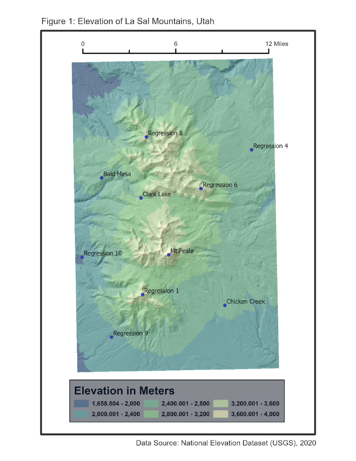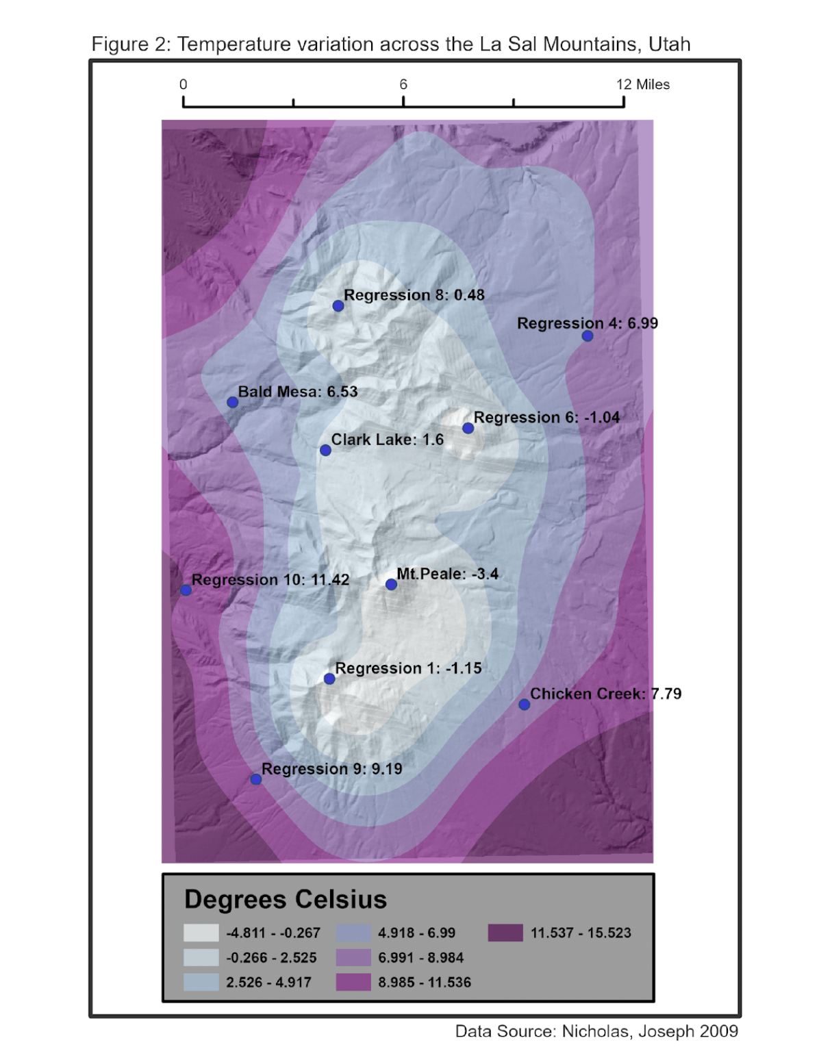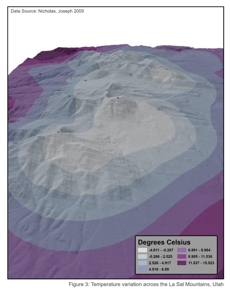
To create these maps I interpolated temperature variance in the La Sal Mountains using temperature data collected at various sites by Dr. Joseph Nicholas. A raster model of temperature was developed using the Spline interpolation method to evaluate extrapolation within that model and temperature’s spatial relationship with elevation data sourced from the National Elevation Dataset (USGS, 2020). These maps were created in the spring of 2023.